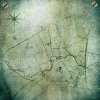
Maps(c.6500 B.C.E)
Some of the earliest known examples of maps in the form of Babylonian tablets-are Egyptian land drawings and paintings discovered in early tombs. However, in 1961 a town plan of Çatalhöyük in Turkey was unearthed, painted on a wall. Featuring houses and the peak of a volcano, it is around 8,500 years old.
Earliest Examples of Map
The sixth-century tablet known as Imago Mundi shows Babylon on the Euphrates, with cities on a circular landmass, surrounded by a river. Some maps are known as T and O maps. In one, illustrating the inhabited world in Roman times, T represents the Mediterranean, dividing the continents, Asia, Europe, and Africa, and O is the surrounding Ocean. The Tand O Hereford Mappa Mundi of 1300, drawn on a single sheet of vellum, includes writing in black ink and water painted green, with the Red Sea colored red.
Greek scholars developed a spherical Earth theory using astronomical observations, and in 350 B.C.E. Aristotle produced arguments to justify this practice.


0 Comments